Case study Modifying (online) maps for temporary adjustments to the road network during the renovation of the Velser tunnel
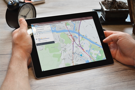
All navigation systems, online maps and traffic apps with up-to-date traffic information and maps come from market parties. For the renovation of the Velser tunnel, an extensive inventory was made of the largest suppliers of online maps regarding what was possible, or not possible, at market level for displaying the temporary road network around the closed Velser tunnel.
This search resulted in an agreement with market party HERE by which they adjusted their online route planner to the current situation with effect from 15 April 2016. In return, the project included the website www.here.com in its communication to road users and stakeholders.
Background and purpose
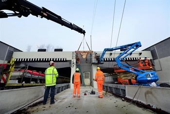
On 15 April 2016, the Velser tunnel was fully closed to traffic for a nine month period. To keep the IJmond region accessible, Rijkswaterstaat built a temporary road network in the region. Road users are increasingly using
in-car navigation, route planners and traffic apps. It was therefore very important for the surrounding area (road users, businesses, and public attractions) to have at least one online route planner that provided the correct travel information after the tunnel was closed.
Scope and effect
It is not possible to give a measurable scope and effect for this measure. At any rate, the measure made an important contribution to creating support for the tunnel closure among stakeholders in the region. Having an assured, correct route planner was a necessity for businesses and public attractions and the project contributed to that with this measure.
Stakeholders responded positively and the measure also led to starting points for jointly considering smart communication with their visitors, employees and suppliers. The synergy with the measure described in the case study IJmondverkeer.nl: website with route and travel time updates was also important.
Points for consideration
- A 'need-to-have' Smart Mobility measure: the problem of inaccurate maps (during the construction of a temporary road network, for example) cannot be solved with traditional mobility measures.
- The big four: all online maps and traffic apps are based on TomTom, Google, HERE or Open Street Map (OSM) maps. So if you want to influence the content of these maps, you must always do business with one or more of these parties.
- (Online) maps and apps versus in-car navigation: there is a big difference in the possibility of modifying (online) maps, traffic apps and in-car navigation. The world of in-car navigation is even more complex than that of (online) maps and apps. So start your process with the low-hanging fruit and not with in-car navigation. For the renovation of the Velser tunnel, HERE was the only provider to adapt its online route planner.
- Technical possibilities: every market party has its own way of working. For the renovation of the Velser tunnel, only HERE modified its online route planner. The other parties appeared to be technically incapable or unwilling to do so.
- Signs displaying 'Navigation off' are still needed. In fact, these signs can only be removed when most of the in-car navigation is able to deliver the correct information to the driver.
- The case study IJmondverkeer.nl: website with route and travel time updates: there was a clear relationship with the measure described in the factsheet on ijmondverkeer.nl. The synchronous implementation of these two measures and the lack of offerings from the market were important considerations in the decision to develop ijmondverkeer.nl. The two measures also complemented each other in the package of project measures.
Can the measure be deployed more broadly?
The measure, or the lessons learned from it, can be used for Rijkswaterstaat's (and other road administrators') projects involving (temporary) adjustments to the road network. Often the tools are produced by market parties, yet government organisations can still focus on them. This can be considered if getting correct information is important to promote traffic flow and avoid bottlenecks.
The market parties are developing rapidly and the possibilities for updating maps are increasing. Each project should therefore take note of the current possibilities and respond to them. If the market is able to make the adjustments itself, government intervention is no longer necessary.
Update 2019
In recent years, there have also been increasing opportunities to include live traffic information and current closures in online navigation services (such as Google Maps). This also makes it possible to include short-term closures (e.g. for night work or an event) in online navigation systems used by road users before and during their journey. At the moment, a lot is still done manually through market participants who can modify maps. It is expected that this process will be automated in the coming years. In the future, it will also be possible to control traffic, such as preventing cut-through traffic by creating obstacles. The technology for this is currently under development.